The Geography of Cambodia Book Publishing is an exploration that I’ve been working on for two years long. Junior Cohort had been traveling around Cambodia, researching and doing a lot of interviewing as well. I’ve been to six provinces which are in the central and northern part of Cambodia. They are Kampong Cham, Tboung Khmum, Kampong Thom, Siem Reap, Preah Vihear, and Oddar Meanchey. We did a lot of research for information in a reliable and credible source as well. Some of the information is from the transcript from Minister of Department of Culture and Fine Art as well. There’s nothing more fun than this; discovering new things, adventurous and learn from it!
Now, here we are in the final stage of publishing this marvelous book. There are 10 members who responsible for different 4 regions. Our design team used a software called “Adobe Indesign” to design the book, but we also used the other software to design the graphics that included in our book as well such as Photoshop, Illustrator etc. On the other hand, the information has to be concise. I enjoy doing this designing, discovering the new tools in Adobe and stretching my brain to think more critically and creatively.
As we’re reading through our book, we feel that we should input more of students voices into the book. That’s why our team came up with the add-ons which are Traditional Belief, Did you know?, Student Observation and Watch out. These add-ons are written from our students who have visited those places. We will include those in the part of the book because we want the reader to understand the Liger students’ perspective of visiting those places.
Not only this, everyone agreed that The Geography of Cambodia book had too much written texts which might lose the reader’s interest. Therefore, the idea of creating more visuals for the text came to our minds. This meant inserting more graphics in the book, which is one of my favorite highlights from this exploration.
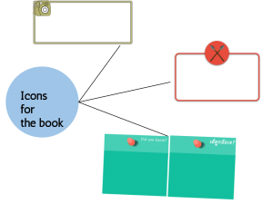
Icons for the book:
- Student Observation (the one with the camera)
- Watch out (the red spear)
- Did you know (sticky note)
- Folklore is the orange rectangle with the text on it
I learnt a lot of skills throughout this exploration. One of the big skills or characteristic is “Calculated Risk Taker”. For me, I had never used Photoshop or any Adobe software before. It is one of the challenges I had faced throughout the process of making graphics design. Be patient is also the thing that not for only me, but everyone should have it. I always say to myself to not give up on what I am doing, because this is the first remarkable product I’ve created. I get out of my comfort zone to try this and the result was amazing. I’ve learned a lot of things; not just only designing skill. Now, I get familiar to it and I feel very proud of myself of what I’m doing!
Overall, I had a fabulous time here by doing something new to myself. I can’t wait to see the books published as well as my teammates do. If there is another exploration that similar to this, I certainly willing to join it. Last but not least, after the book published I hope that everyone learns and proud of our book; well they will!
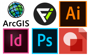
Software or website that we use to design and make graphics in The Geography of Cambodia book:
- ArcGIS
- Flaticon
- Adobe Illustrator
- InDesign
- Photoshop
- Google Drawing


